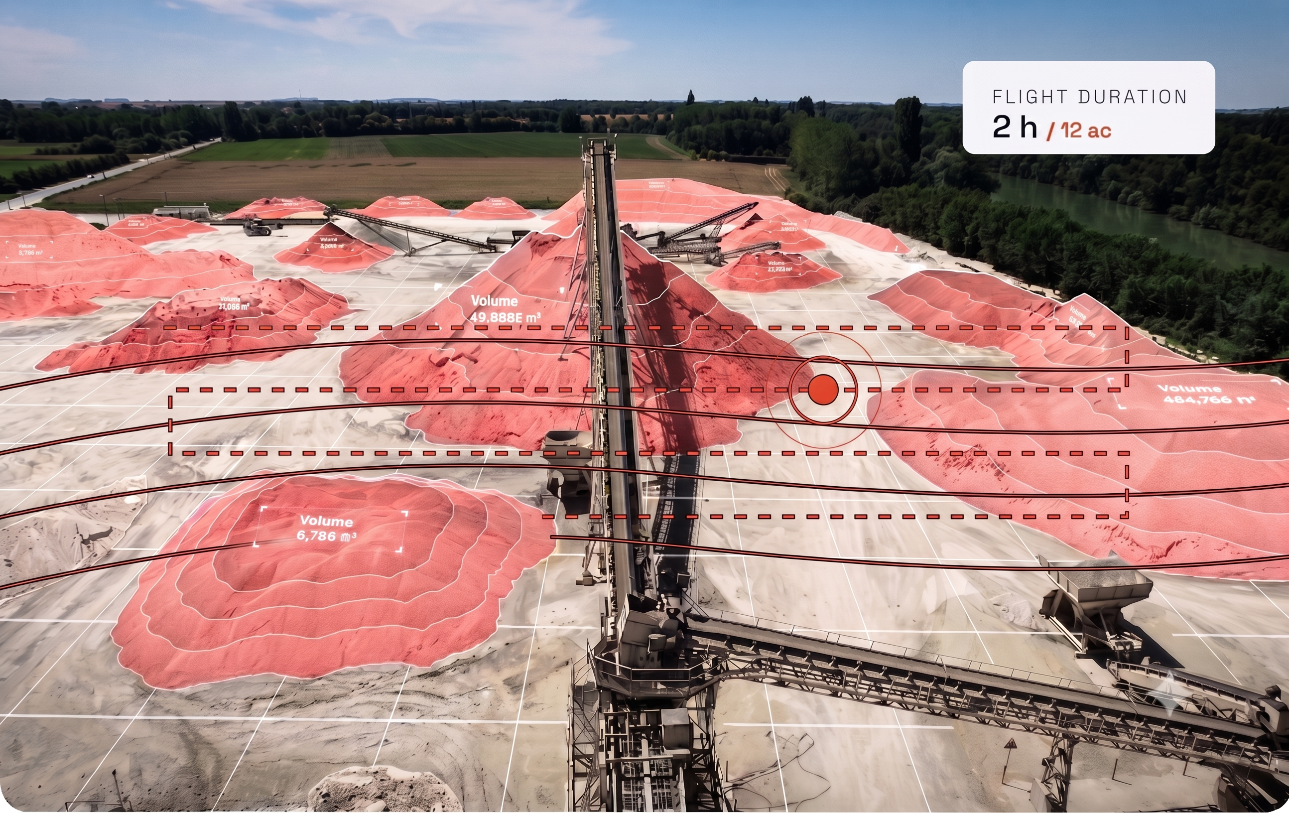
Survey a 12-acre site in 2 hours of flight time, versus nearly 100 hours with traditional ground-based methods.
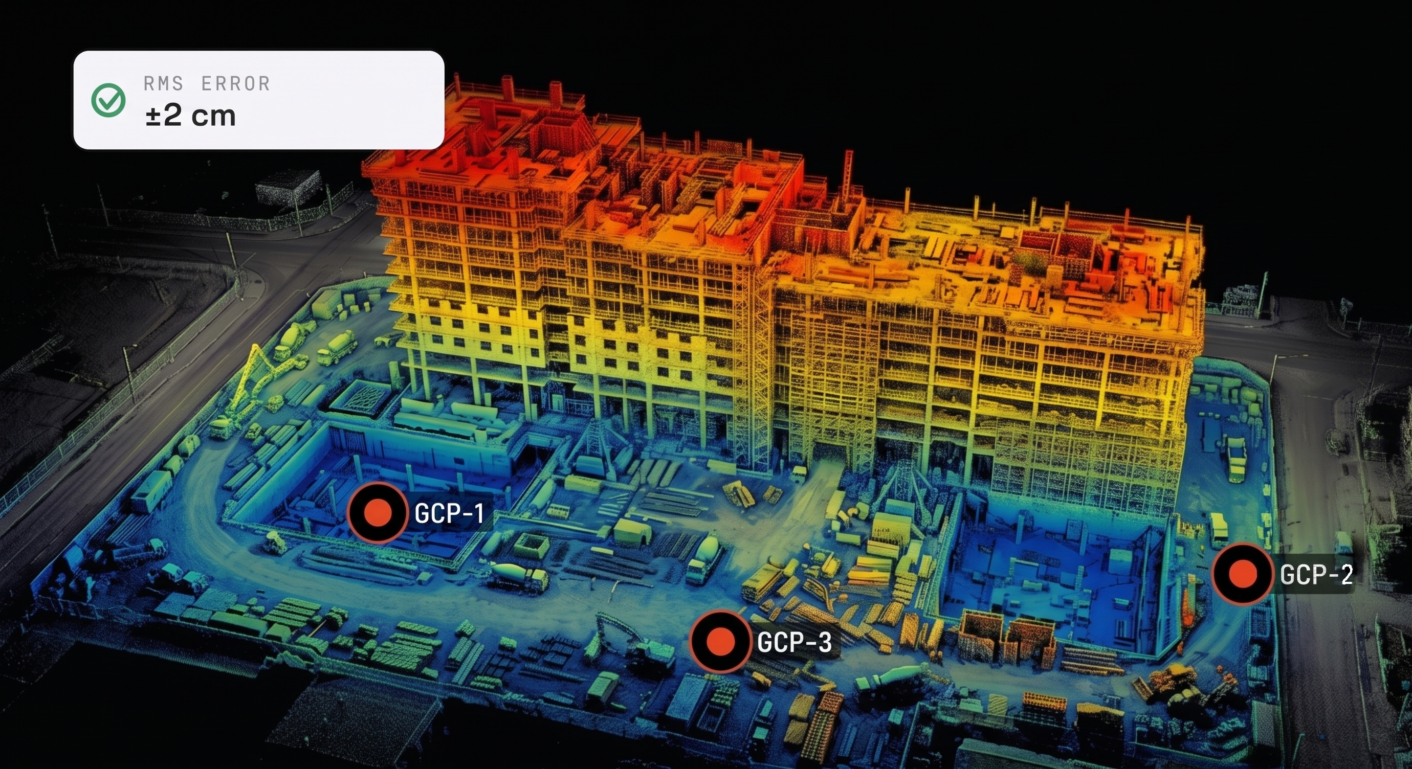
Deliver ±2 cm ground accuracy with georeferenced GCP control points, verifiable on every mission.
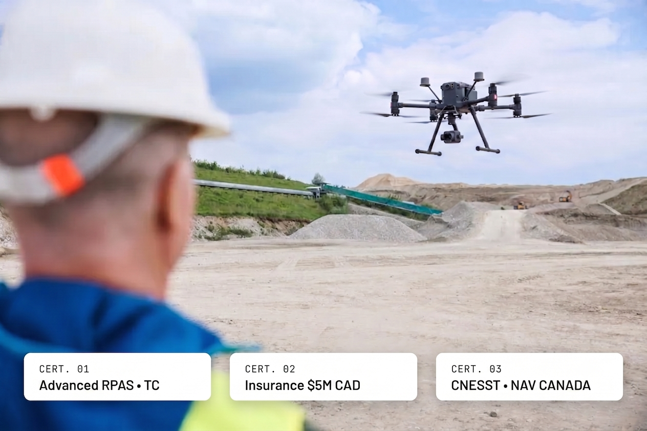
Certified Advanced RPAS by Transport Canada, $5M CAD liability insurance, integrated CNESST coordination.
From flight planning to the exported file, your project managers and engineers integrate the data directly.
We walk you through the full process, from Transport Canada authorizations to final deliverables. No technical jargon required. You stay in control of your site with a provider who owns the complexity.
See the WorkflowDiscover our four B2B packages built around construction's specific pain points. Monitoring subscriptions, LiDAR surveys, BIM integration, envelope diagnostics. Contractual guarantees included.
See the PackagesFive steps, one processing pipeline, one point of contact. You give us access to the site. We deliver the files to your teams.
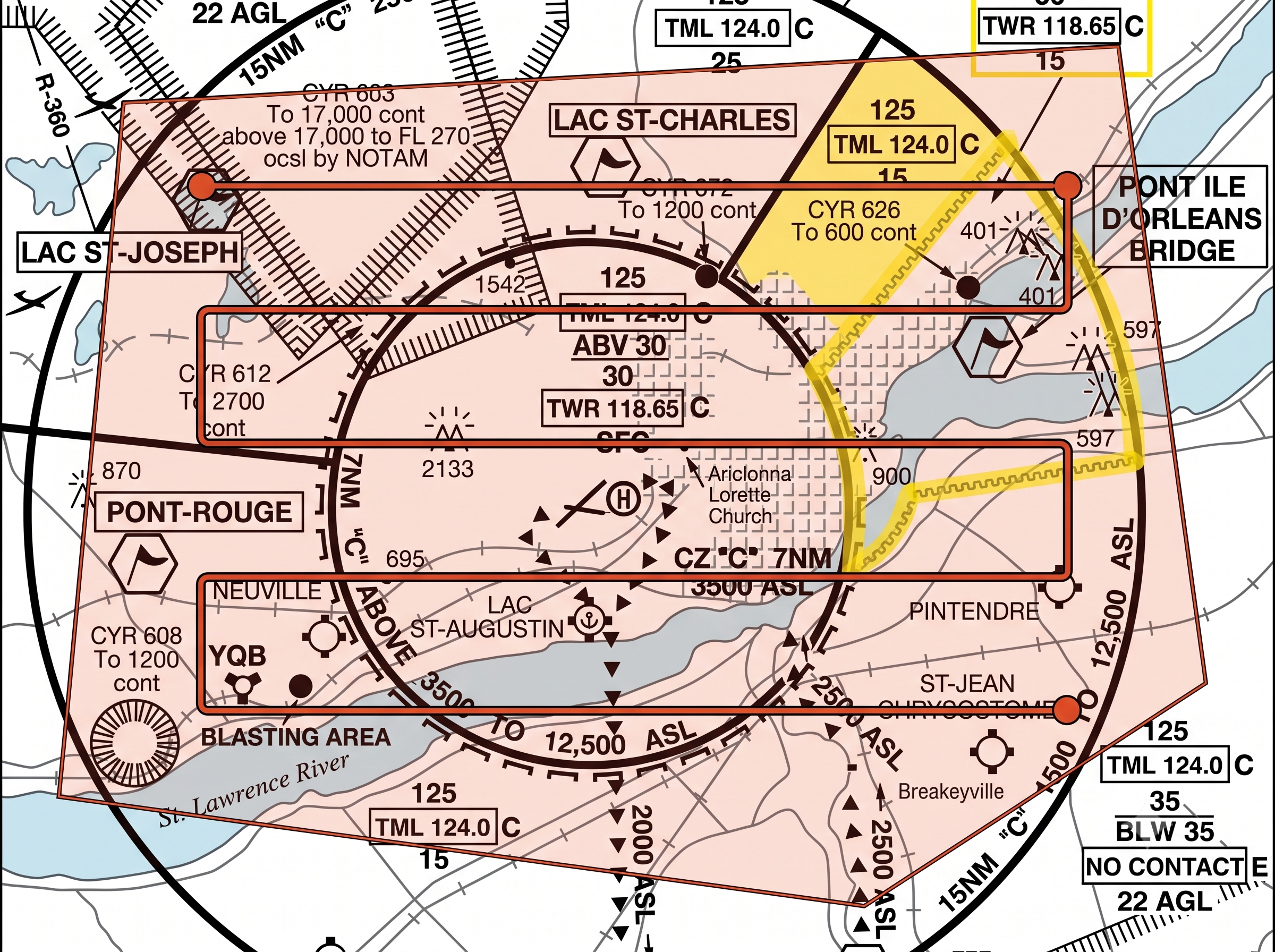
The Québec City region sits almost entirely within CYQB controlled airspace. We handle the NAV Drone request, notice to the site's prime contractor, and coordination with the site's CNESST prevention program.
The drone flies alongside heavy machinery. No site shutdown, no surveying crew to mobilize. Ground control points establish the accuracy you can prove to your clients.
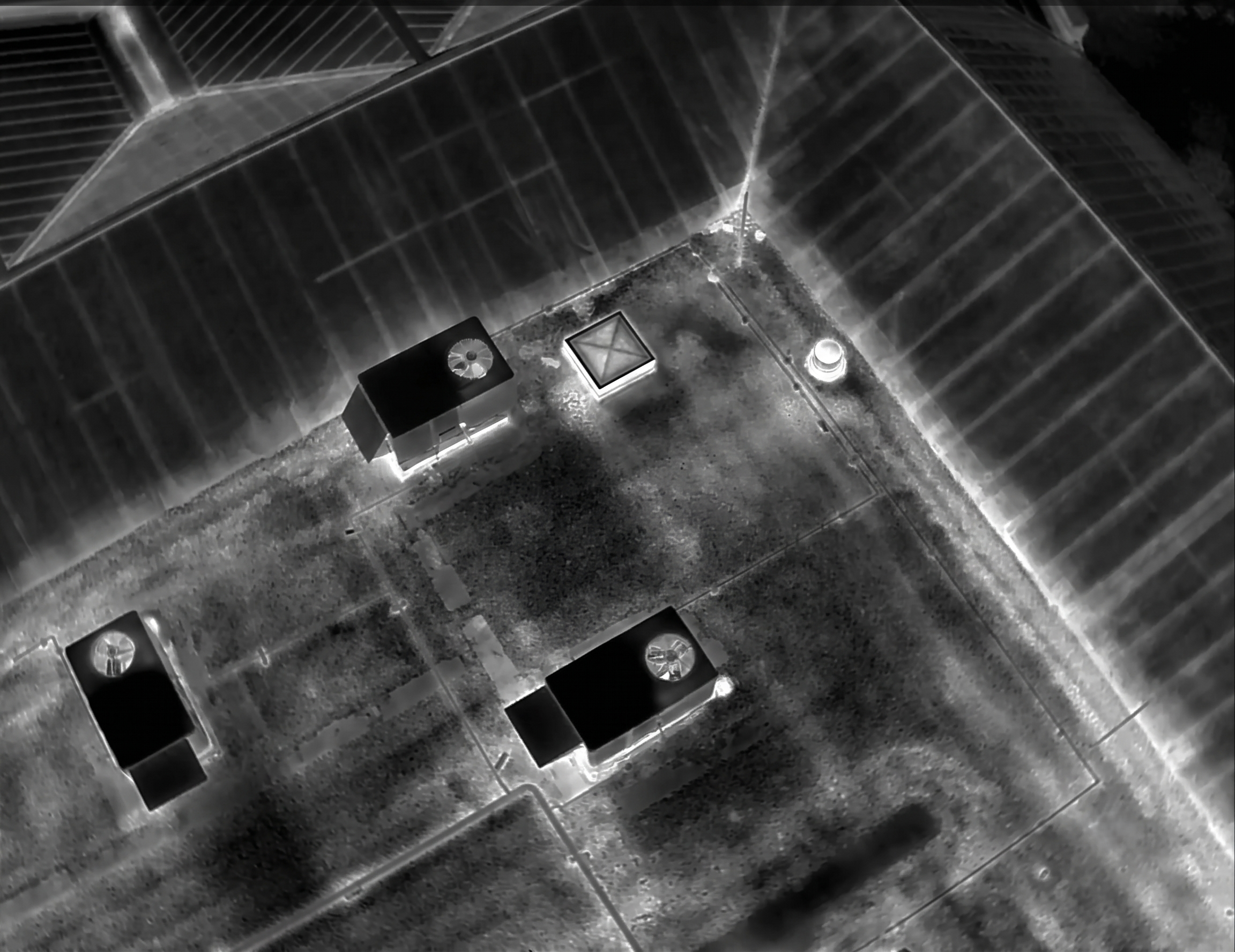
Our processing pipeline generates orthophotos, digital models, and point clouds within 48 hours of the flight. Miss the deadline, and an automatic 50% penalty applies to the invoice. It's in the contract.
Your project managers open the portal, compare progress week over week, and measure a distance or volume directly on screen. No heavy file transfers, no software to install on the client side.
The government's 2021–2026 BIM roadmap mandates structured digital data. We export in the formats your engineers and architects open without an intermediate conversion, ready for the SQI's common data environment.
The drone doesn't replace your engineers or surveyors. It removes the longest part of their job, raw data collection, and gives them back time for what actually matters.
A single flyover generates more measurements than a ground crew collects in a week. Even hard-to-reach areas are covered without deploying scaffolding or a lift.
One capture produces multiple deliverables. If project requirements evolve along the way, your teams draw from data already collected instead of remobilizing a ground crew.
With reliable raw data delivered to their desk, your surveyors and engineers focus on validation, quality control, and decision-making instead of field collection.
Indicative estimate based on our average capture ratios. Every engagement is confirmed with a precise quote.
Each package solves one precise operational problem for one specific role on site. No generic service. Every package includes a contractual guarantee that shifts the financial risk onto AltiMetrix, not onto you.
100% of your subcontractor progress claims validated without dispute, month after month, for the entire duration of the project.
Centimeter-level topographic modeling delivered to estimators in 48 hours, without stopping heavy machinery.
An as-built digital twin that integrates without conversion into your common data environment, compliant with SQI requirements.
Complete thermal and visual inspection of facades and roofs, with zero exposure of your teams to fall risks.
Regulatory compliance isn't a marketing pitch. It's the condition for setting foot on your site. Here's what's non-negotiable on our end.
Issued by Transport Canada. Required to operate in CYQB controlled airspace and within 30 m of workers on job sites.
Every RPAS in our fleet is listed with a Declaration of Safety Assurance (DAS) accepted by Transport Canada for advanced operations.
Aviation and general commercial liability coverage. The prime contractor can be added as an additional insured on request.
Integration into the prime contractor's prevention program. Flight notice and NAV CANADA authorizations for every mission in controlled airspace.
Three common job site profiles in the region, with the order-of-magnitude results our flights and processing pipeline deliver.
A 20-minute consultation to identify the two or three moments where a drone genuinely changes your timeline and your budget. No generic pitch, just your project.
A question before booking? Check our Q&A →
Choose the time that works for you. The appointment is automatically added to our calendars and you'll receive an email confirmation.
